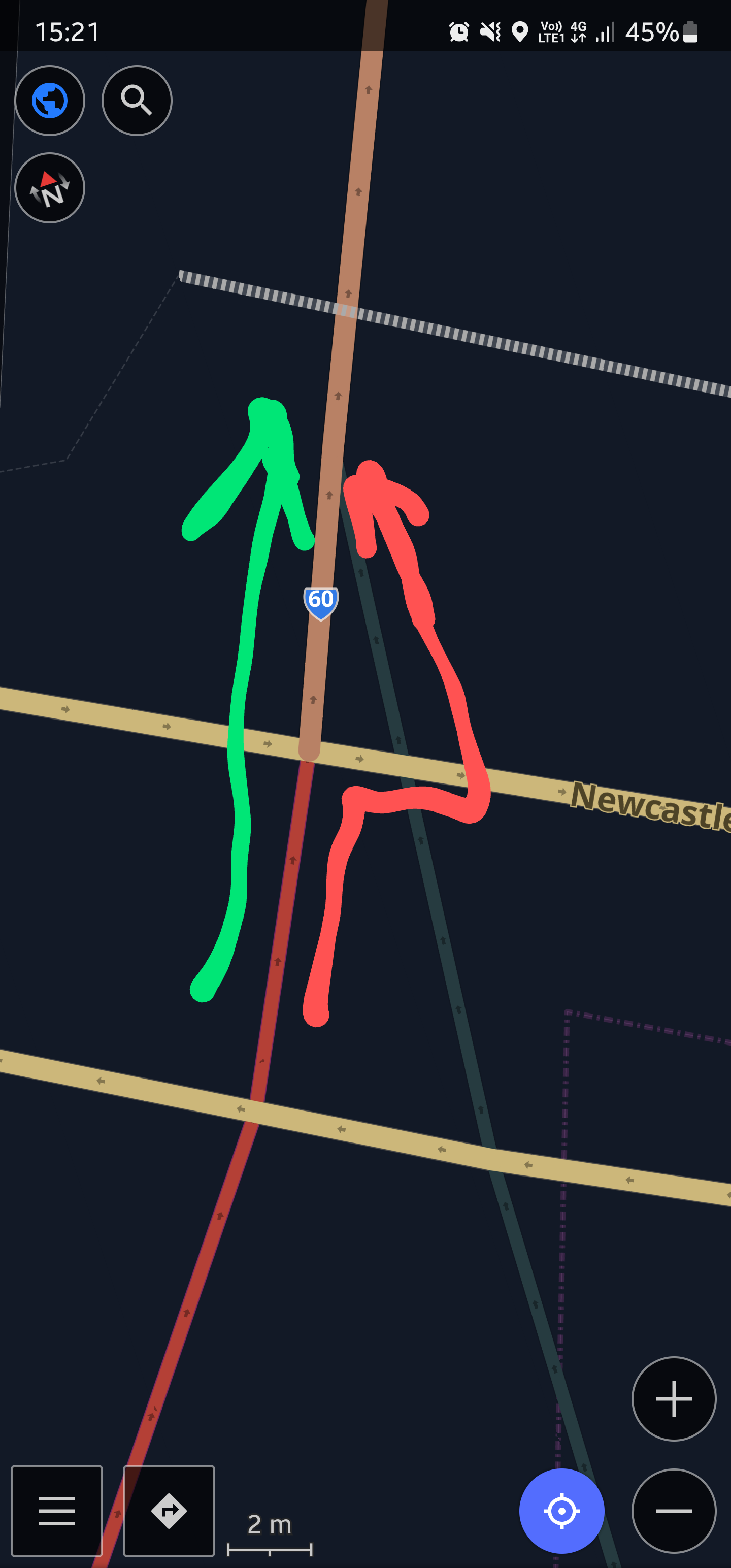
Can you give more information on the exact location and route? For the life of me I can't match your OsmAnd screenshot to the OSM online map. I can identify Newcastle St and the #60 highway, but I, for example, can't see where the dark green road is.
OpenStreetMap community
Everything #OpenStreetMap related is welcome: software releases, showing of your work, questions about how to tag something, as long as it has to do with OpenStreetMap or OpenStreetMap-related software.
OpenStreetMap is a map of the world, created by people like you and free to use under an open license.
Join OpenStreetMap and start mapping: https://www.openstreetmap.org/.
There are many communication channels about OSM, many organized around a certain country or region. Discover them on https://openstreetmap.community/
https://mapcomplete.org/ is an easy-to-use website to view, edit and add points (such as shops, restaurants and others)
https://learnosm.org/en/ has a lot of information for beginners too.
For some reason I can't attach a picture, so I'll try and describe it. If you can find those two roads, then they should just be at the intersection,but you may need to zoom in quite a bit, it's a very small bus road that comes from somewhere in between the #2 on and off ramp. #2 raps are the red ones in the screenshot
Ah, ok, got it now. I couldn't zoom in enough on the map itself, I had to go into the editor.
However that bus lane seems to be tagged correctly, so OsmAnd should never be routing over it. I tried it on my phone and it routed correctly.
I can only suggest to post in a more official community such as Github Discussions. Try making a screen shot of OsmAnd actually routing along there. Also add following link to the bus lane: https://www.openstreetmap.org/way/706585631
It's not exactly correct tag, I mean not the most common, I haven't found any documentation about motor_vehicle=bus. The preferred tagging should be motor_vehicle=no with bus=designated or psv=designated. These two combinations are more common than this one, it's possible that osmand developers didn't care about this rare tag.
Also the small triangle shouldn't exist, the bus road should end at the intersection of the other two roads.
@[email protected] So i not just osmand, the map isn't perfect as well.
I see, I'll change that stuff soon then. What you suggest does make more sense than what's already there
I already fixed the map: https://www.openstreetmap.org/changeset/137823354 I think after the next osmand update it should work fine
Nice, thanks!

