this post was submitted on 27 Nov 2023
911 points (98.7% liked)
Funny: Home of the Haha
5222 readers
1131 users here now
Welcome to /c/funny, a place for all your humorous and amusing content.
Looking for mods! Send an application to Stamets!
Our Rules:
-
Keep it civil. We're all people here. Be respectful to one another.
-
No sexism, racism, homophobia, transphobia or any other flavor of bigotry. I should not need to explain this one.
-
Try not to repost anything posted within the past month. Beyond that, go for it. Not everyone is on every site all the time.
Other Communities:
-
/c/[email protected] - Star Trek chat, memes and shitposts
-
/c/[email protected] - General memes
founded 1 year ago
MODERATORS
you are viewing a single comment's thread
view the rest of the comments
view the rest of the comments
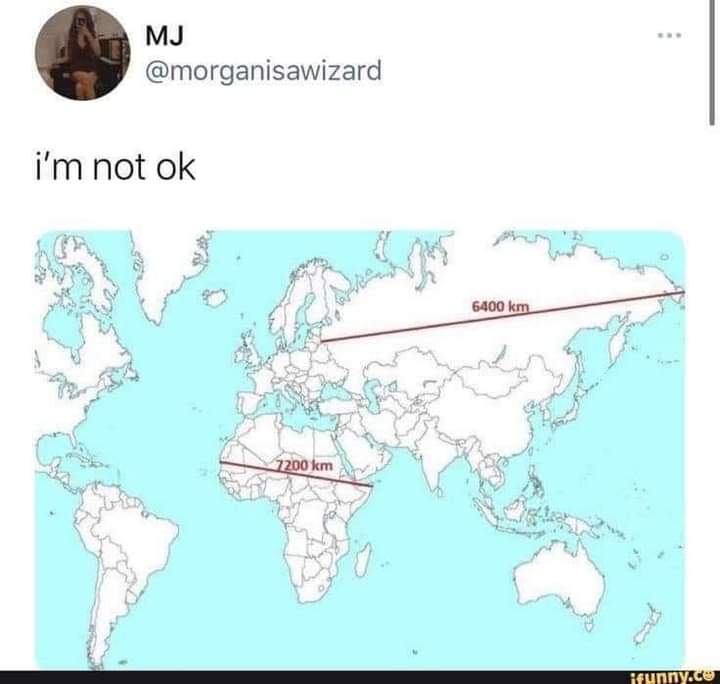
Effectively no. Any projection of a spherical surface into 2D will distort it in some way. If I understand correctly, the Mercator projection (which I think is what we're looking at) is a cylindrical projection, which preserves latitude but severely distorts longitude near the poles.
I do know that aeronautical charts are conical projections, which is fairly distortion free for the relatively small area they cover, but you can't lay more than a few of them edge to edge before things stop lining up.
You have distort some thing. Scale or directions. The one most people use keeps directions constant. Ie a 45 degree line between North and east will akways point due northeast no matter where it is.
Contrast that with a map that cuts out large triangle sections or naos that have tge equator wider then poles. These maps make true northeast variable.