this post was submitted on 05 May 2024
453 points (98.5% liked)
People Twitter
5957 readers
3638 users here now
People tweeting stuff. We allow tweets from anyone.
RULES:
- Mark NSFW content.
- No doxxing people.
- Must be a pic of the tweet or similar. No direct links to the tweet.
- No bullying or international politcs
- Be excellent to each other.
- Provide an archived link to the tweet (or similar) being shown if it's a major figure or a politician.
founded 2 years ago
MODERATORS
you are viewing a single comment's thread
view the rest of the comments
view the rest of the comments

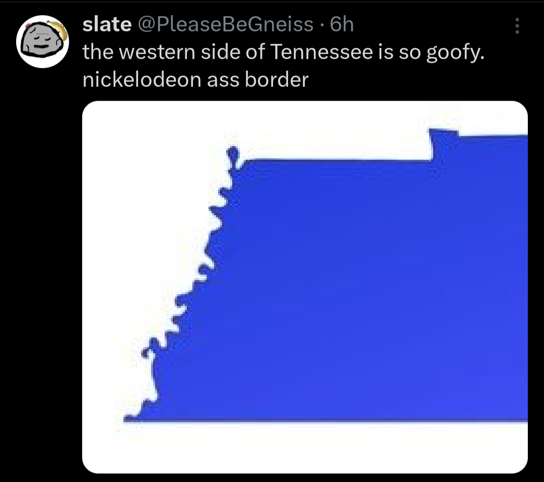
People saying "ya it's called natural borders yank" as if they don't come from countries where borders are decided instead by whoever was fucking over whichever disenfranchised minority group at any given time.
Also I actually think borders should be set at watershed boundaries instead of rivers since a lot of cities end up sprawling onto both sides of a river divide. The continental US should have 8 states,
Longhouse at the North Eastern watersheds,
Sherman along the southeastern, Tennessee Valley, and lower Mississippi watersheds
Ohiagan along the Ohio, Great Lakes, Upper Mississippi, and Sourris Red watersheds
Texas along the Rio-Grande and Texas Gulf watersheds
Buffalo along the Missouri and Arkansas watersheds
Sierra along the Colorado and Great Basin watersheds
California at the California Watershed
Cascadia at the PNW Watershed
Counterpoint: I ain't sharing a state with missouri
silence Missouri toucher
Rename the Southeast to Sherman? I would like to subscribe to your newsletter.
🤮🤮
A chance to undo Ohio and he only made it bigger
I mean the only other option that'd even kinda work for the whole region is Tecumseh
Fun fact: watersheds are how we define our regions in NZ.
Though a region may consist of more than one watershed, but not less than one or a partial one.
What happens when the river moves though?
WAR!!!
Nothing, the watershed boundaries are the points where water stops flowing towards one body of water and starts flowing towards another.
I know what a watershed is, we're talking about borders between states.
Draw a squiggly line that follows the river. You get the left side, I get the right side. The river moves as rivers do. After 100 years we do a survey and find I have a big chunk of property that used to be my side of the river but the river moved towards me and now that's on your side of the river. I've lost some land due to some being on the other side of the river and more due to the land I used to have being a river now.
Is the boundary between us the water and we put up with the uncertain nature of our property, or do we honour the line drawn 100 years ago even though the river isn't anywhere near there now?
I'm pretty sure rivers don't run along watershed borders. Which are the borders OP is suggesting.
That squiggly line is the Mississippi river.
You're the only one talking about rivers in this sub-thread. Not that watershed boundaries can't change.
They change but much more slowly since they change with long term changes in terrain, as opposed to the natural weathering effect of a river, especially one that meanders.
Plus greater watershed boundaries tend to settle around mountain fronts or peaks as well as other such difficult terrains that are less prone to hosting large settlements that could hypothetically get cut off from their own greater metro area, and more likely to already form their own natural barriers just because that happens to be the places where water will begin moving in the other direction towards a different outlet.
Well I see now I commented on the wrong thread.
You can't make me do anything with Ohio