NASA's Perseverance Mars Rover
1392 readers
44 users here now
On the plains of Jezero, the secrets of Mars' past await us! Follow for the latest news, updates, pretty pics, and community discussion on NASA and the Jet Propulsion Laboratory's most ambitious mission to Mars!
founded 1 year ago
MODERATORS
1

3

4
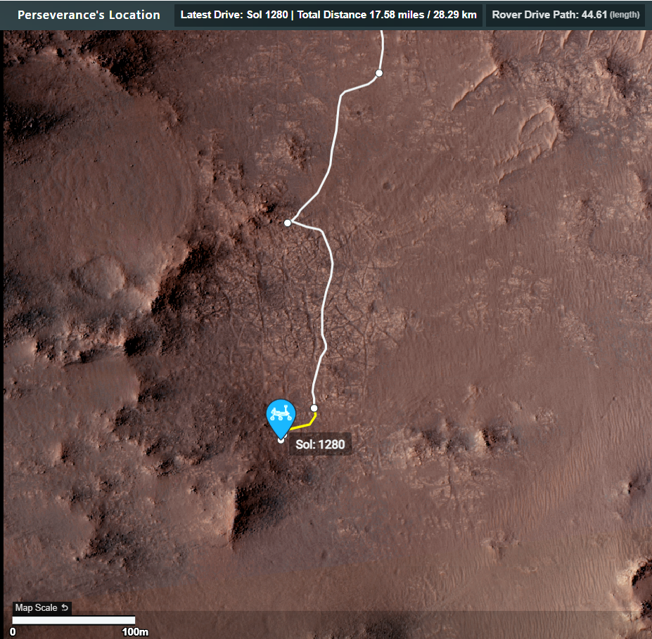
This was a short drive of just 21.22 meters (69.62 ft) I suspect that the drive algorithms terminated the drive earlier than planned in the soft terrain. Zoom in on the regolith in the wheel tracks, it is bunched up as a result of wheel spin. If one or more of the rover's wheels spins at different rates it can be detected by the rover's computers. Set limits are defined at the onset of each drive for the acceptable amount of spin, if the rover reaches those limits the drive is halted and the rover calls home. We currently have to wait about 6 months to read the mission managers reports (in the mission PDS) to see what is reported about this drive, but the images tell a story of wheel slip. There's a long drive / climb to reach the crest of the crater rim. It's going to take a lot of drives to reach the rim (slow but sure)
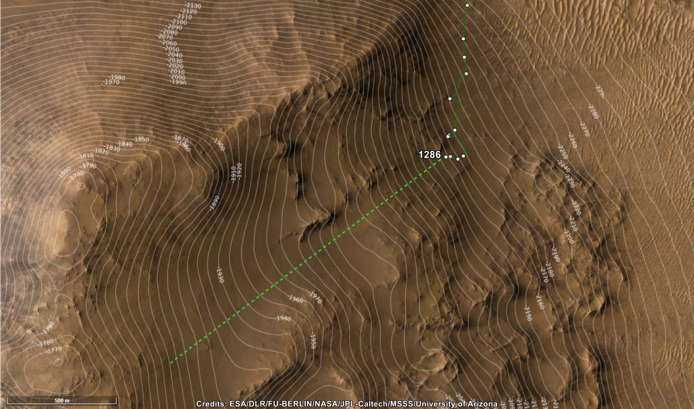
I'll post a map with contours separately

5
I've also annotated one of the notional paths where you can see the climb and distance to the rim of the crater. The contours are 10 meters apart

7
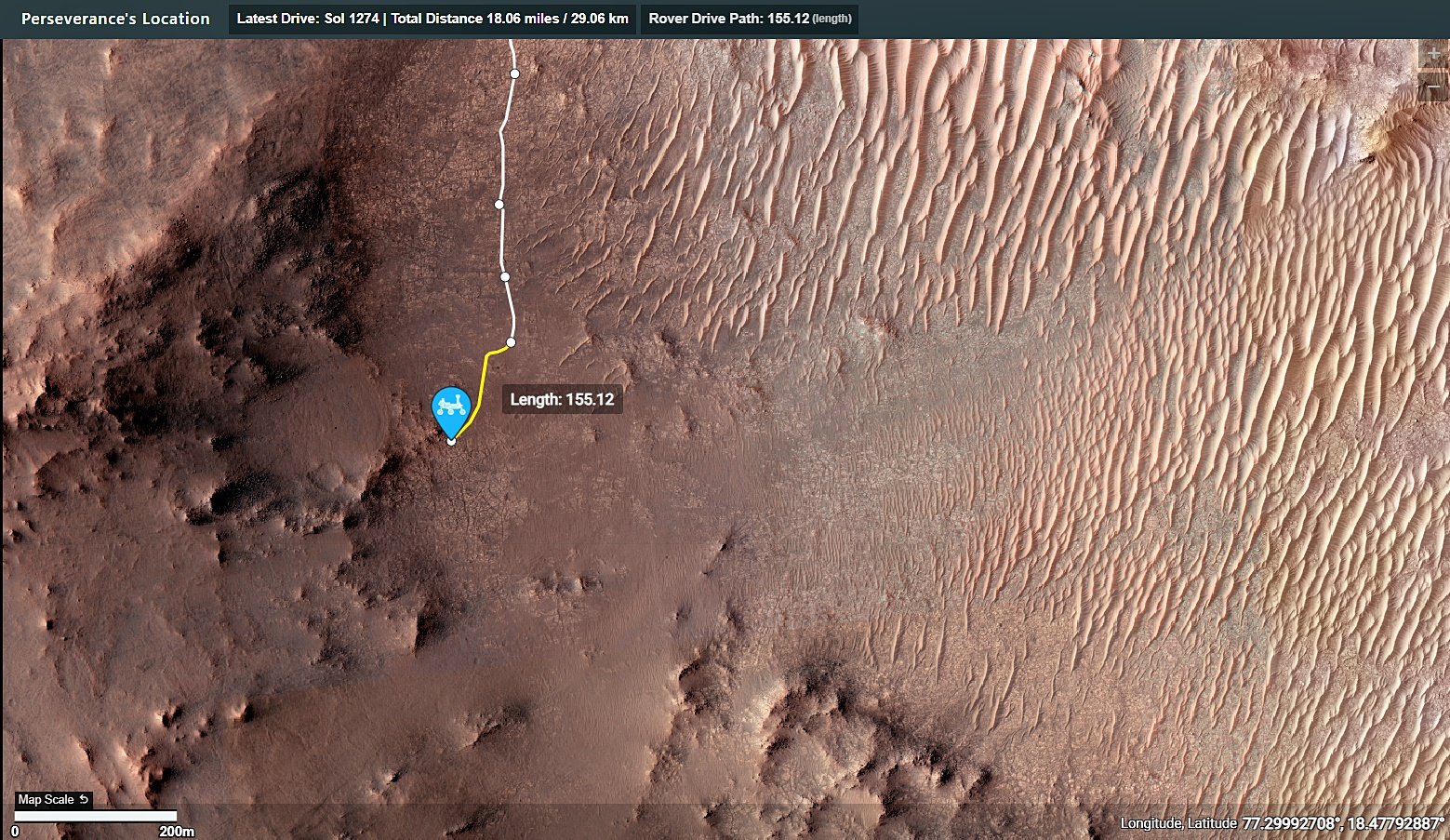
This is just a screen capture: Visit the mission map on https://mars.nasa.gov/maps/location/?mission=M20

8
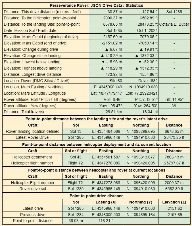
- Drive Date: October 1, 2024 (Sol 1285)
- Distance: 38.87 meters (127.54 ft)
- Climb: 6.07 meters (19.91 ft)
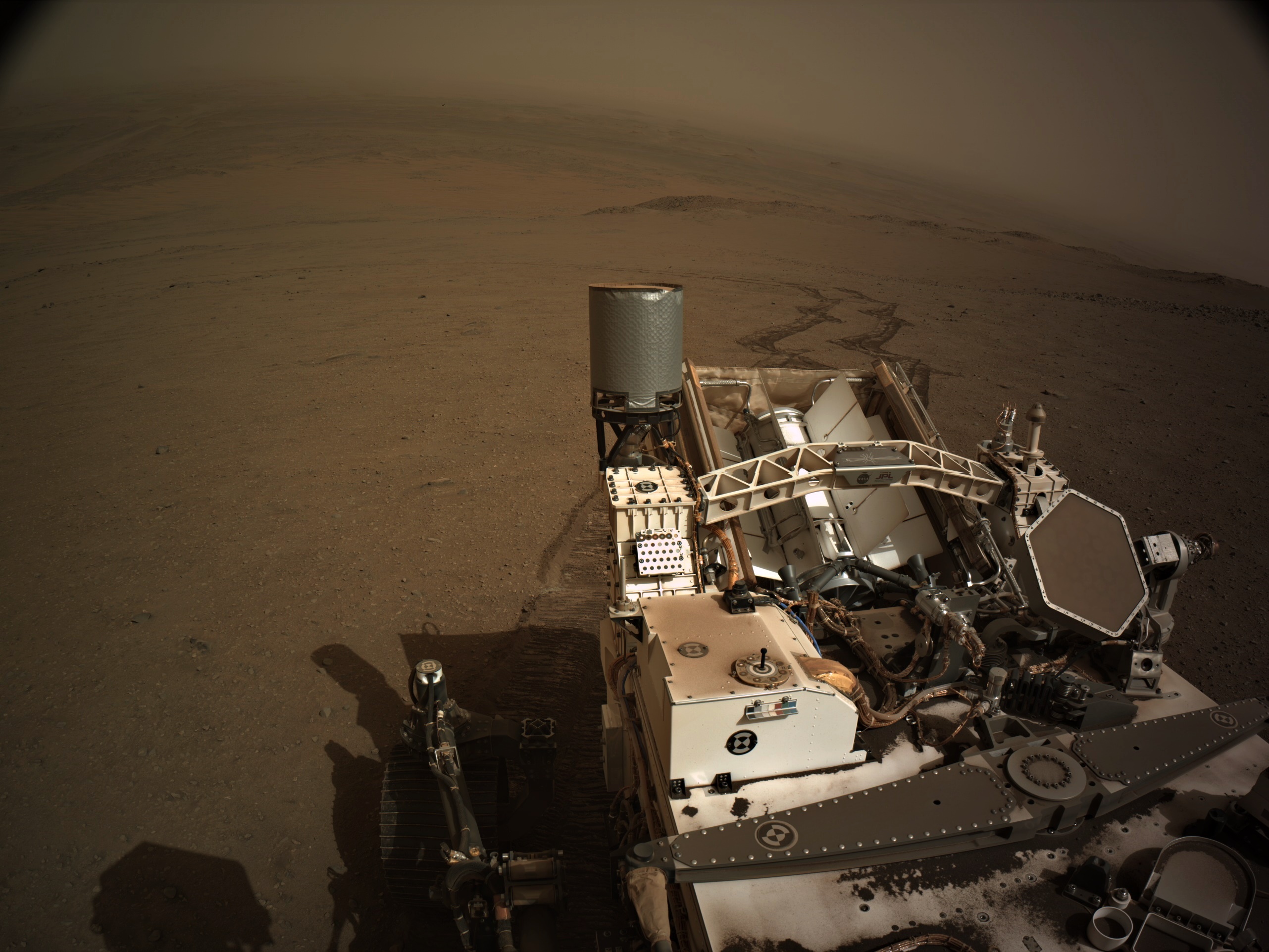
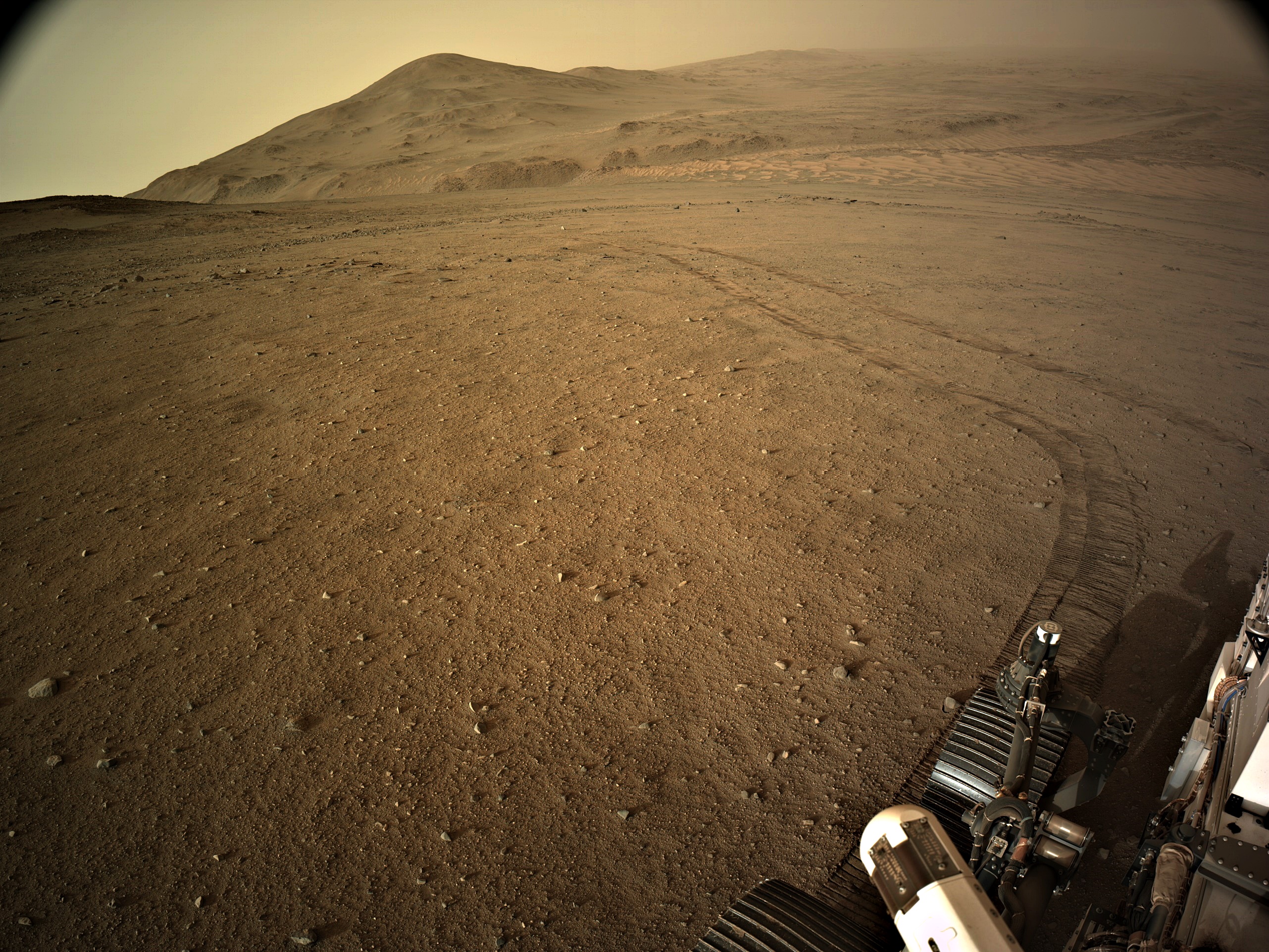
- 4-tile NavCam image
- Zig-Zag course was likely to maintain traction on the steep slope covered with loosely packed regolith
- The path ahead is similar terrain, so I assume we'll see more drives like this during the climb
9
For those that like the small details . Like the fact that the distance between the rover and the helicopter just went over 2km (2000.37 meters (6562.89 ft)
10
36
1284 - Drive: 40 meters, Climb: 7.5 meters, getting a little wheel slip, and the local dust storm is spoiling the view
(lemmy.world)
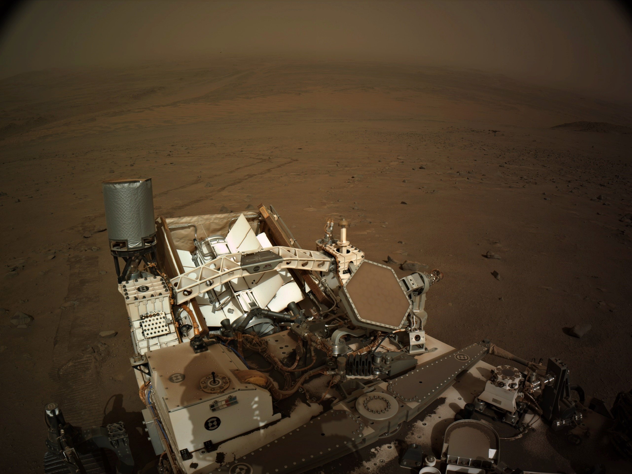
Post-drive 4-tile NavCam mosaic looking Northeast after the drive.
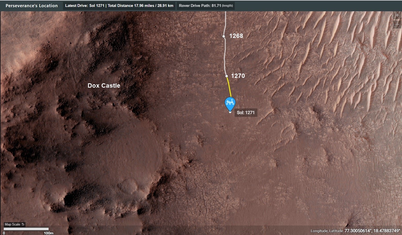
The rover has returned to its notional path, having driven away from 'Dox Castle'. The terrain on the path is similar to what we see in this image, so we may encounter a degree of wheel slip and deeper tracks. That will usually result in shorter drives.
I'll post the map and drive data in separate posts
Beautifully processed by James Sorenson. Credits: NASA/JPL-Caltech/James Sorenson
edit: fixed typo

11
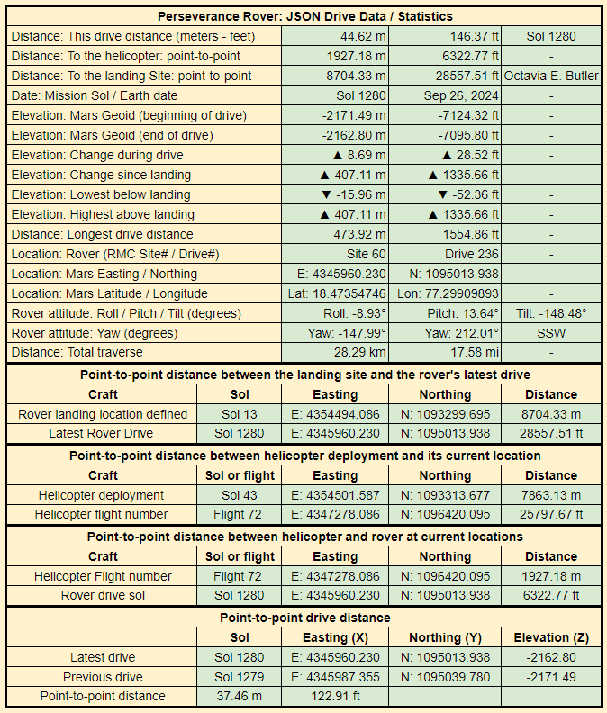
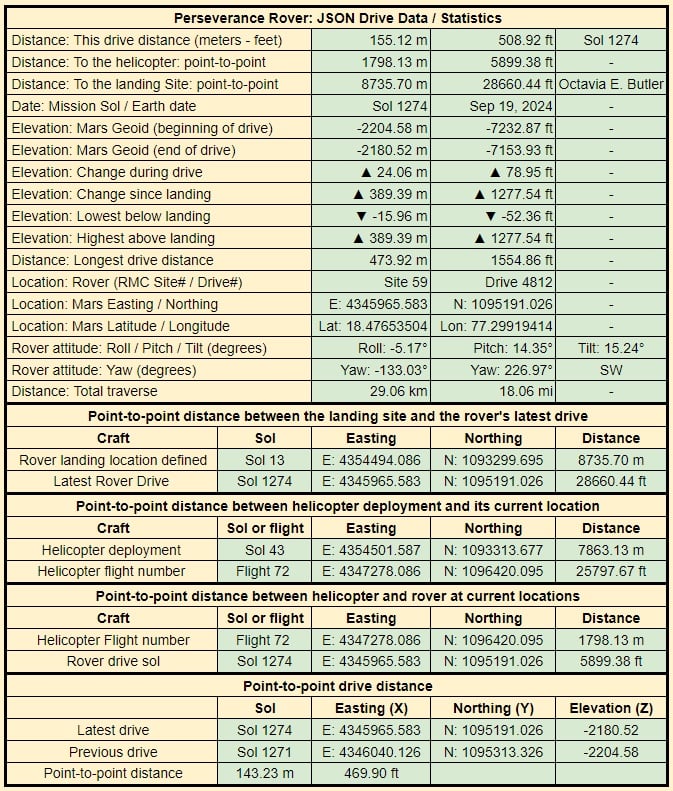
Data provided by JPL shortly after each drive, all I do is gather the data and present it in this table

12
Waiting for the official distance / elevation change etc. But it looks like a good drive :)
13
16
There was another drive on 1278, oddly reported as 1289 on the mission map. Whichever is correct the distance was 178 meters with a climb of 9 meters
17
18
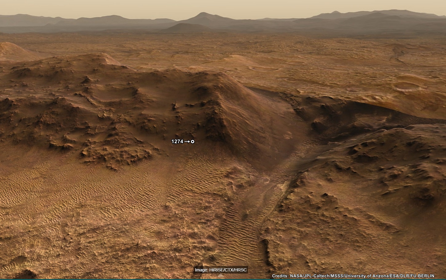
Perseverance rover has reached new heights as it ascends the rim of Jezero crater, currently 389 meters (1277 ft) in elevation higher than the original landing site )! The rover is located at its first crater rim campaign science stop at a location called 'Dox Castle', a region of interest for its potential to host ancient Mars bedrock in the exposed rocks on the rim. Impact craters like Jezero may be the key to piecing together the early geologic history of Mars, as they provide a window into the history of the ancient crust by excavating and depositing deep crustal materials above the surface. Crater rims act as keepers of ancient Martian history, uplifting and exposing the stratigraphy of these impacted materials. Additionally, extreme heat from the impact can encourage the circulation of fluids through fractures similar to hydrothermal vents, which have implications for early habitability and may be preserved in the exposed rim bedrock. With the Perseverance rover we have the potential to explore some of the oldest exposed rocks on the planet.
This panoramic scene is created by processing images and data from the orbiting assets of NASA and ESA, it was processed by Freie Universität Berlin. Image Credits: NASA/JPL-Caltech/MSSS/University of Arizona/ESA/DLR/FU-BERLIN
19
20
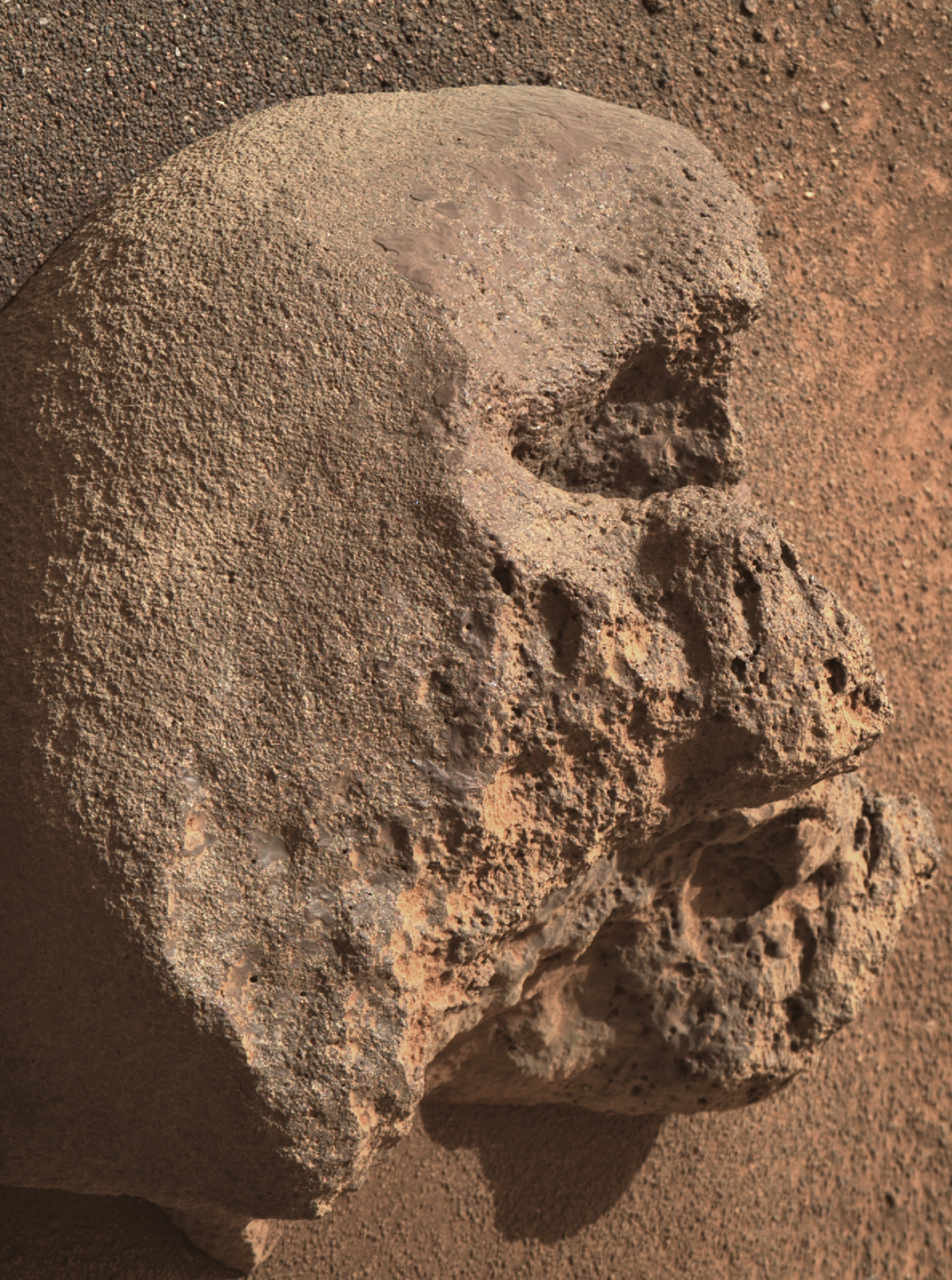
Rotation required by Pareidolia ;)
R-MastCam-Z: 110mm (full zoom)
Mast Azimuth: 68.8394
Mast Elevation: -39.732
Sol 1274 (September 20, 2024)
Site: 59.3872
NASA/JPL-Caltech/ASU/MSSS
21
22
Drive was during September 19, 2024 - Data from JPL
23
Awaiting the official distance and the updated traverse map.
Looking at the post drive images I presume that we are still on the margin unit, but very close to the basal unit of the crater rim (just beyond the workspace).
JPL stated that "Dox Castle" is a major science waypoint, but we're probably a little south of the location shown on an earlier map, but we are close to the transition zone.
Except for a series of short walkabout drives we could be around here for some time examining the transition between the rim and the rocks formed in the ancient lake. I'll share the official traverse map and drive data as soon as it is released.
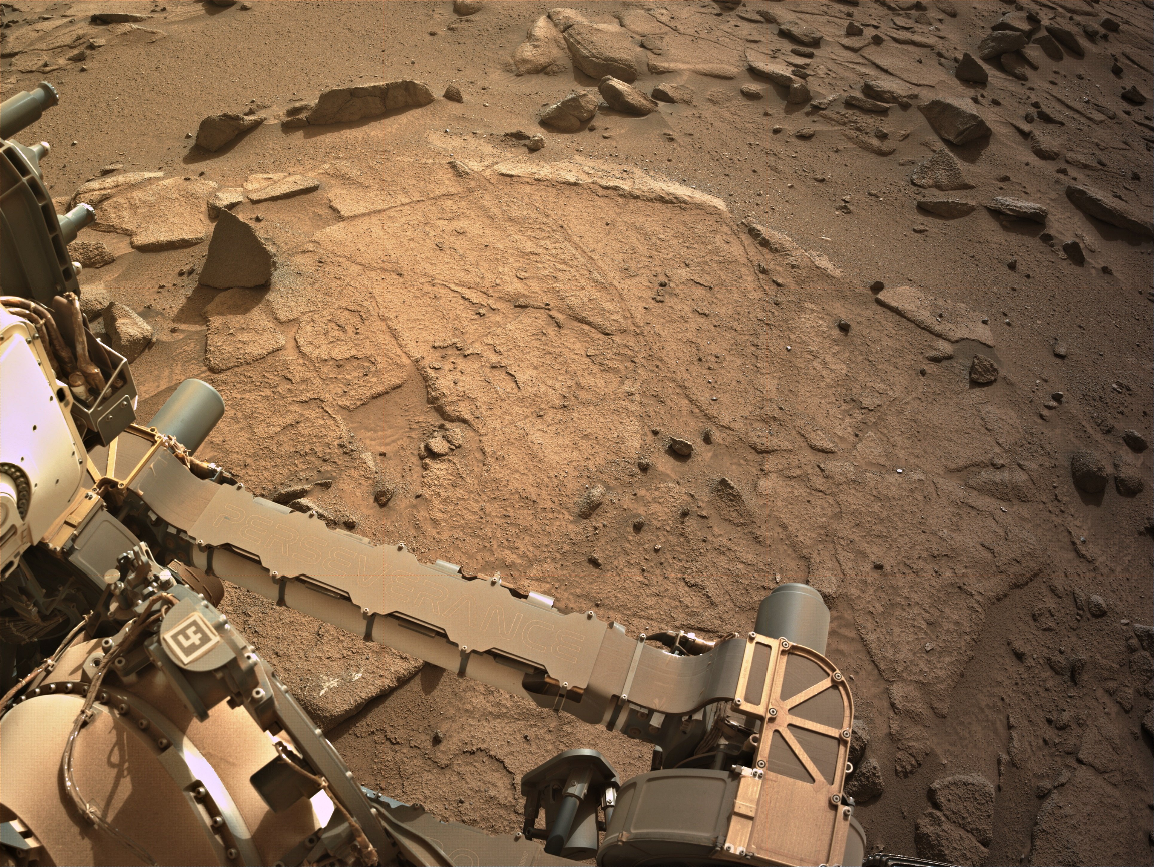
Attached is a 9-tile end-of-drive L-NavCam composite, featuring the rover's robotic arm workspace
Size - 3862x2902px
Assembled in MS-ICE.
Site - 96-4812.
Sol 1274 - September 19, 2024.
Credits: NASA/JPL-Caltech
24
Perseverance Mars rover is on its ascent to the rim of Jezero Crater, and it captured a portion of the journey with one of its navigation cameras. Forty-five frames were stitched together to create this video showing the rover's progress on Aug. 22, 25, and 26, 2024, the 1,247th, 1,250th, and 1251st Martian days, or sols, of the mission. During the time period captured, Perseverance covered a distance of about 530 feet (160 meters) and gained about 115 feet (35 meters) in elevation.
Credit: NASA/JPL-Caltech/PIA26376

25
Dox Castle will be our first chance to do rim science, to search for evidence of the transition between the margin and rim materials, and to start piecing together the stratigraphic history of the rocks that make up the rim of Jezero crater.
view more: next ›