Space_Cat_95

joined 1 year ago
[–] [email protected] 0 points 1 year ago

This reads like someone’s first undergrad comparative Econ paper.

[–] [email protected] 1 points 1 year ago

Depending on the the type of map I’ll use Adobe Fresco or Illustrator on an iPad. Although I’ll sometimes grab a high resolution scan of a real atlas and draw on it with Procreate.

[–] [email protected] 1 points 1 year ago

In my games it feels like players want the world/region maps more than the local ones. Playing on a VTT scrambles this a bit as people expect battle maps, but I still spend more time on the region views

[–] [email protected] 2 points 1 year ago (1 children)

Very neat. So are the brushes to make the roads?

I always wanted to base a campaign around traveling back and forth along single road or river.


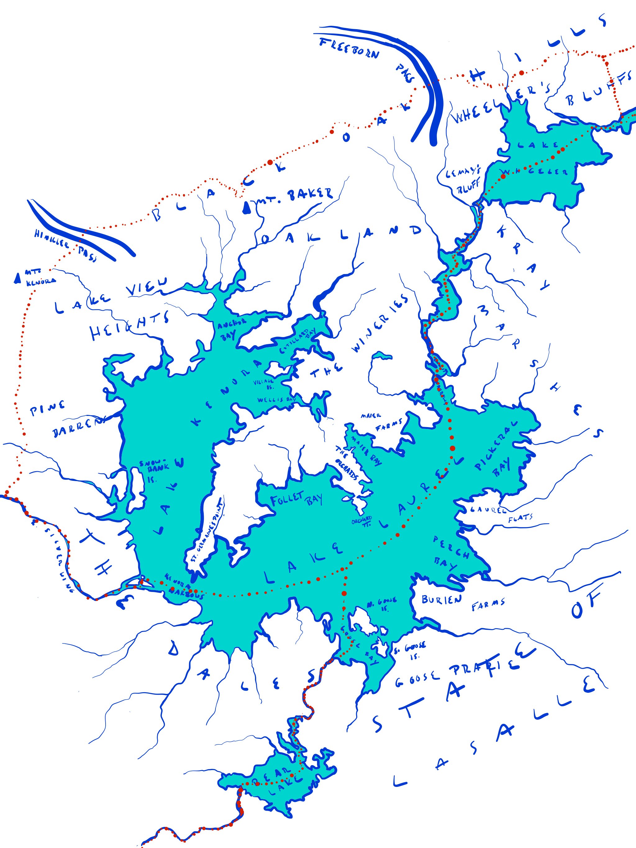
I worked on this map while brainstorming an TTRPG setting a few years back. I never ended up using it however. The Lake Laurel region is inspired by the large glacial lake systems you see in the northern US and throughout Canada.

The northern stretch of the region consists of rolling foothills and some mountains. Its densely forested. The southeastern shore of Lake Laurel is mostly flat with broad grassy marshes.

I always imagined that there would be a city state on the peninsula that divides the lakes. The heroes would come from there and most of the adventures would be based around it. People would get around in boats and hunker down during the long winters.

[–] [email protected] 1 points 1 year ago

Lovely map. Varying the thickness of the lines really helps it come alive.

[–] [email protected] 2 points 1 year ago

I started at the just after 5.0 was released. It will be exactly four years this weekend.

[–] [email protected] 5 points 1 year ago

I love when my players get deeply immersed in a scenario I created and engage with all of the NPCs and create a story we’ll tell each other for years.