
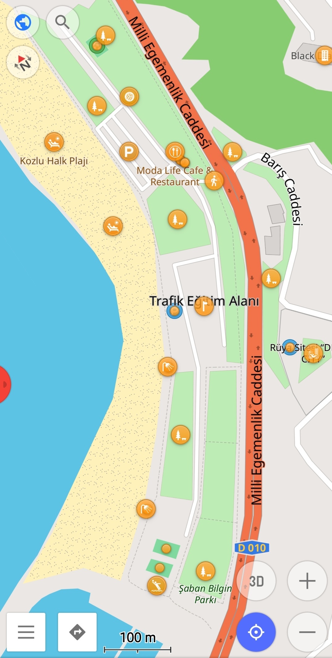
It hasn't been a week since I met OSM and Osmand. And I created all the beaches in a city from scratch. I added the important points in detail with their labels. I took long walks and it was fun.
Everything #OpenStreetMap related is welcome: software releases, showing of your work, questions about how to tag something, as long as it has to do with OpenStreetMap or OpenStreetMap-related software.
OpenStreetMap is a map of the world, created by people like you and free to use under an open license.
Join OpenStreetMap and start mapping: https://www.openstreetmap.org.
There are many communication channels about OSM, many organized around a certain country or region. Discover them on https://openstreetmap.community
https://mapcomplete.org is an easy-to-use website to view, edit and add points (such as shops, restaurants and others)
https://learnosm.org/en/ has a lot of information for beginners too.
It hasn't been a week since I met OSM and Osmand. And I created all the beaches in a city from scratch. I added the important points in detail with their labels. I took long walks and it was fun.
Nice job! It's not that hard to find where you worked if you include some text, it's here: https://www.osm.org/#map=17/41.44296/31.74970
Some tips:
place=localitytag on this thing is wrong: https://www.openstreetmap.org/way/1302651829 I can't figure out what is that from the aerial imagery, but locality in osm terminology is something different:Maybe the translation is wrong in the editor for this item, I see you used Turkish language. If it's some kind of an empty plaza or paved place, use
place=square(wiki) orhighway=pedestrian+area=yes: a hard-surfaced, open pedestrian area: https://wiki.openstreetmap.org/wiki/SquareThese are small problems, it's really nice, keep up the good work!
It's also recommended to reach out to the local community, they can help a lot. You can find your official channels on this site for any place of the World: https://openstreetmap.community/?map=36.94533,34.03161&zoom=5.52
Thanks for the tips. I will be better soon.
You are already in the top 40 in Turkey: https://osmstats.neis-one.org/?item=countries&country=Turkey
See your stats here: https://hdyc.neis-one.org/?Alpagun
Wow, I didn't know there was such a statistics page. It's nice. Thanks