this post was submitted on 07 Jul 2024
220 points (95.5% liked)
Data is Beautiful
852 readers
279 users here now
Be respectful
founded 2 months ago
MODERATORS
you are viewing a single comment's thread
view the rest of the comments
view the rest of the comments
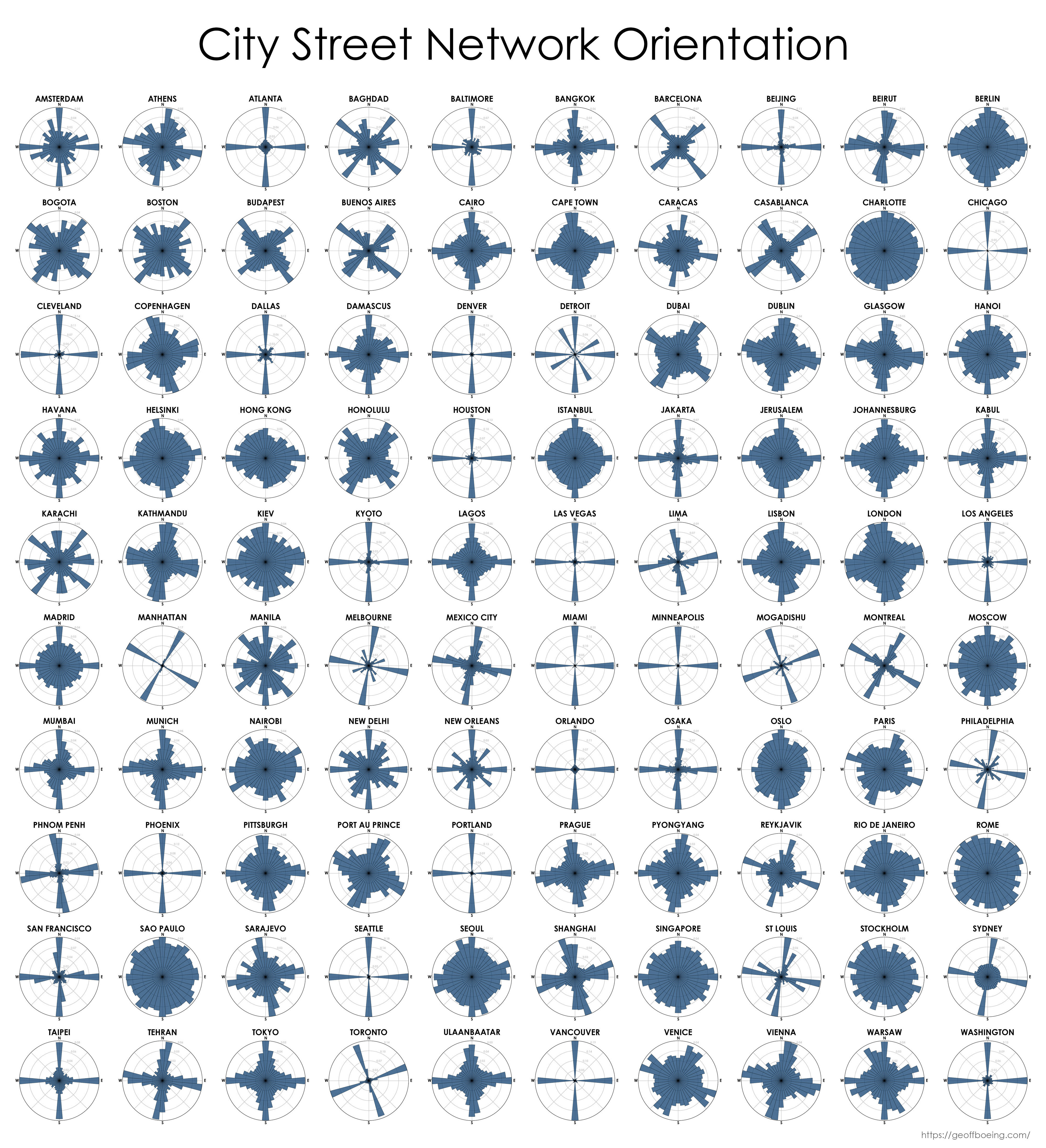
I might be a moron here, but I have no idea how to interpret this. Is each blue bar the proportion of streets that run in that direction? Do the ones that just have a single bar at N/E/S/W have perfectly aligned streets that only go in the cardinal directions?
Also, how is the direction assigned? Especially for streets that are not straight? For example taking a beginning and end and measuring their angle wouldn't be very representative. And how does it work with long and short streets? Are longer more heavily represented, or do they count the same? I'd like it if it took a tangent to the street every 100 m or so, but somehow I doubt that's what they did.
I had presumed it's the angles of the intersections.
So basically angles of ends of streets. Well, there are many options and we just don't know which one it is.